Fugro Business Model Canvas

Strategic Business Model Canvas: value, partners, revenue and scalable risk controls
Discover Fugro’s strategic blueprint in a concise Business Model Canvas that maps value propositions, key partners, revenue streams and scalability drivers. This snapshot reveals how Fugro wins contracts and mitigates risk across geographies. Purchase the full, editable Canvas for section-by-section insights and actionable strategies.
Partnerships

Offshore engineering and EPC partners
Collaborating with offshore engineering and EPC firms embeds Fugro geo-data into design and delivery, aligning site characterization with construction schedules to reduce rework and delays. Joint planning de-risks interfaces and enables bundled value propositions, unlocking share in multi-year infrastructure programs worth over $100bn annually in 2024. These partnerships support access to long-term contracts and larger integrated scopes.
Technology and sensor manufacturers
Partner with OEMs for advanced sensors, AUVs/ROVs and positioning systems to secure bespoke payloads and tight integration, improving data quality and survey efficiency. Co-developing payloads shortens deployment time and enables higher-resolution outputs, supporting Fugro’s operations across ~60 countries (2024). Early access to OEM innovations strengthens service differentiation, while vendor support lowers downtime and reduces lifecycle costs.

Satellite, remote sensing, and data platform providers
Fugro partners with satellite imagery and InSAR providers (including free Sentinel SAR data) to augment in-situ surveys, integrating multi-source feeds into unified analytics platforms. With over 6,000 active satellites in orbit by 2024, these partnerships boost spatial-temporal coverage and accelerate insights, enabling scalable monitoring subscriptions for continuous asset and infrastructure surveillance.

Maritime logistics, vessel, and port services
Alliances with vessel owners, shipyards and port authorities secure operational availability and helped Fugro sustain global project delivery in 2024; the group reported approximately EUR 1.2bn revenue in 2024 supporting offshore surveys.
Shared logistics and crewing reduce mobilization times and lower charter costs, while local partners ensure compliance and permitting, cutting operational risk in complex geographies.
- Operational availability: vessel/port alliances
- Efficiency: shared logistics & crewing
- Compliance: local permitting support
- Risk/cost reduction in challenging regions
Academia, research institutes, and regulators
Engage universities and standards bodies to advance geoscience methods, leveraging joint research that validates models and sustains Fugro’s thought leadership; Fugro reported 2023 revenue of €1.66bn (published 2024) which funds R&D collaborations. Regular dialogue with regulators ensures compliant methodologies and helps shape emerging guidelines for sustainable development across offshore and onshore projects.
- Academia partnerships: joint validation and publications
- Standards bodies: method harmonization
- Regulators: compliance + guideline shaping
- Funding: 2023 revenue €1.66bn (published 2024)
EPC-integrated geodata taps $100bn+ market; satellites scale monitoring
Collaborating with EPCs embeds Fugro geo-data into delivery, reducing rework and tapping >$100bn/yr infrastructure programs (2024). OEM, AUV/ROV and satellite partners (Sentinel InSAR; 6,000+ satellites) boost data quality and monitoring across ~60 countries, supporting ~€1.2bn revenue (2024). Vessel, crewing and academic alliances cut mobilization, lower costs and fund R&D via €1.66bn 2023 revenue (published 2024).
| Partnership | Key metric |
|---|---|
| EPCs/Clients | >$100bn market (2024) |
| OEMs/AUVs | ~60 countries coverage |
| Satellites | 6,000+ active (2024) |
| Vessels/Operations | €1.2bn revenue (2024) |
| Academia/R&D | €1.66bn revenue (2023) |
What is included in the product
 Detailed Word Document
A comprehensive Business Model Canvas tailored to Fugro’s geotechnical, survey and subsea services, covering customer segments, channels, value propositions and revenue streams aligned with real-world operations. Organized into the 9 classic BMC blocks with SWOT and competitive-advantage analysis, ideal for investor presentations and strategic decision-making.

 Customizable Excel Spreadsheet
High-level, editable Fugro Business Model Canvas that condenses complex geotechnical and survey services into a one-page snapshot—saving hours of structuring while enabling fast team collaboration, comparison, and board-ready presentations.
Activities

Integrated geo-data acquisition
Execute coordinated marine and onshore surveys using vessels, AUVs/ROVs, drones and land crews to collect geophysical, geotechnical, hydrographic and environmental data. Operate across more than 60 countries, standardizing acquisition to ISO and IHO benchmarks for comparability and quality. Optimize campaigns to prioritize safety, lower cost and minimal environmental impact through route planning, remote vehicles and real-time QA/QC.
Data processing, analytics, and modeling
Process raw measurements into cleaned, fused datasets using Fugro’s global field data (company founded 1962, operating in 60+ countries with around 10,000 employees in 2024). Apply AI/ML, geostatistics and digital twins to generate insights. Build predictive models for soil behavior, asset integrity and hazards. Deliver decision-ready outputs through dashboards and APIs.

Site characterization and engineering advice
Translate geophysical and geotechnical data into engineering parameters and design recommendations, enabling foundation sizing, seabed bearing capacity and lateral resistance estimates for foundations and pipelines; Fugro is headquartered in Leidschendam, Netherlands and operates in 60+ countries. Support foundation selection, routing and construction methods with site-specific surveys and numerical models. Provide quantified risk assessments, mitigation strategies and probabilistic failure analyses. Advise on standards compliance and prepare permitting documentation for regulators and lenders.

Asset inspection, monitoring, and integrity management
Perform periodic and continuous monitoring of offshore and onshore assets using tethered sensors and autonomous systems to reduce exposure and cost, detecting anomalies, scour, subsidence and fatigue early. Data-driven alerts inform maintenance planning and life-extension decisions across projects.
- Continuous monitoring: ~30% less unplanned downtime (2024 industry avg)
- Autonomous systems: up to 50% inspection cost reduction (2024 trials)
- Early detection: potential 10–20% asset life extension (2024 studies)
Project management and HSE excellence
Plan, mobilize and deliver multi-country, multi-vessel projects across 60+ countries with 100+ vessels (2024), sequencing resources to meet contracted timelines and budgets. Maintain robust HSE, quality and data governance systems to sustain low incident rates and audit-ready data trails. Coordinate stakeholders and supply chain, ensure regulatory compliance and transparent reporting to clients and regulators.
- Scope, mobilization, delivery
- HSE, quality, data governance
- Stakeholder & supply chain coordination
- Regulatory compliance & transparent reporting
Global marine/onshore surveys in 60+ countries with 100+ vessels, AI risk analytics
Execute coordinated marine/onshore surveys across 60+ countries using 100+ vessels and AUVs/ROVs, collecting geophysical, geotechnical, hydrographic and environmental data. Process data with AI/ML and digital twins to deliver engineering parameters and probabilistic risk analyses. Provide continuous monitoring, asset integrity and permitting support to clients and lenders. Maintain HSE, quality and data governance.
| Metric | 2024 |
|---|---|
| Countries | 60+ |
| Employees | ~10,000 |
| Vessels | 100+ |
Full Version Awaits
Business Model Canvas
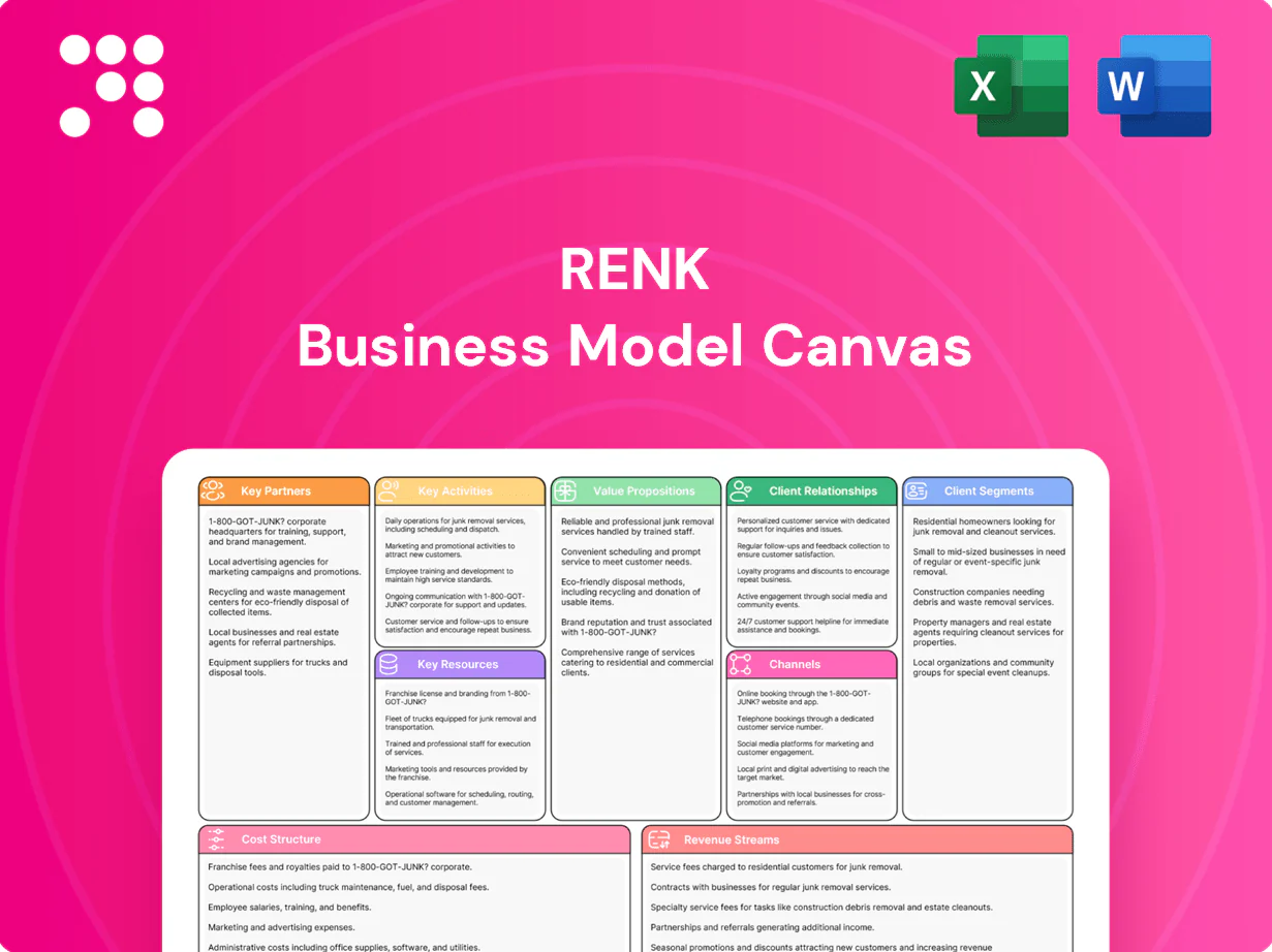
The Fugro Business Model Canvas shown here is the actual deliverable—not a mockup. When you purchase, you’ll receive this exact document (complete and editable) in Word and Excel formats, fully formatted and ready to present, edit, or share without alterations.

Strategic Business Model Canvas: value, partners, revenue and scalable risk controls
Discover Fugro’s strategic blueprint in a concise Business Model Canvas that maps value propositions, key partners, revenue streams and scalability drivers. This snapshot reveals how Fugro wins contracts and mitigates risk across geographies. Purchase the full, editable Canvas for section-by-section insights and actionable strategies.
Partnerships
Offshore engineering and EPC partners
Collaborating with offshore engineering and EPC firms embeds Fugro geo-data into design and delivery, aligning site characterization with construction schedules to reduce rework and delays. Joint planning de-risks interfaces and enables bundled value propositions, unlocking share in multi-year infrastructure programs worth over $100bn annually in 2024. These partnerships support access to long-term contracts and larger integrated scopes.
Technology and sensor manufacturers
Partner with OEMs for advanced sensors, AUVs/ROVs and positioning systems to secure bespoke payloads and tight integration, improving data quality and survey efficiency. Co-developing payloads shortens deployment time and enables higher-resolution outputs, supporting Fugro’s operations across ~60 countries (2024). Early access to OEM innovations strengthens service differentiation, while vendor support lowers downtime and reduces lifecycle costs.
Satellite, remote sensing, and data platform providers
Fugro partners with satellite imagery and InSAR providers (including free Sentinel SAR data) to augment in-situ surveys, integrating multi-source feeds into unified analytics platforms. With over 6,000 active satellites in orbit by 2024, these partnerships boost spatial-temporal coverage and accelerate insights, enabling scalable monitoring subscriptions for continuous asset and infrastructure surveillance.
Maritime logistics, vessel, and port services
Alliances with vessel owners, shipyards and port authorities secure operational availability and helped Fugro sustain global project delivery in 2024; the group reported approximately EUR 1.2bn revenue in 2024 supporting offshore surveys.
Shared logistics and crewing reduce mobilization times and lower charter costs, while local partners ensure compliance and permitting, cutting operational risk in complex geographies.
- Operational availability: vessel/port alliances
- Efficiency: shared logistics & crewing
- Compliance: local permitting support
- Risk/cost reduction in challenging regions
Academia, research institutes, and regulators
Engage universities and standards bodies to advance geoscience methods, leveraging joint research that validates models and sustains Fugro’s thought leadership; Fugro reported 2023 revenue of €1.66bn (published 2024) which funds R&D collaborations. Regular dialogue with regulators ensures compliant methodologies and helps shape emerging guidelines for sustainable development across offshore and onshore projects.
- Academia partnerships: joint validation and publications
- Standards bodies: method harmonization
- Regulators: compliance + guideline shaping
- Funding: 2023 revenue €1.66bn (published 2024)
EPC-integrated geodata taps $100bn+ market; satellites scale monitoring
Collaborating with EPCs embeds Fugro geo-data into delivery, reducing rework and tapping >$100bn/yr infrastructure programs (2024). OEM, AUV/ROV and satellite partners (Sentinel InSAR; 6,000+ satellites) boost data quality and monitoring across ~60 countries, supporting ~€1.2bn revenue (2024). Vessel, crewing and academic alliances cut mobilization, lower costs and fund R&D via €1.66bn 2023 revenue (published 2024).
| Partnership | Key metric |
|---|---|
| EPCs/Clients | >$100bn market (2024) |
| OEMs/AUVs | ~60 countries coverage |
| Satellites | 6,000+ active (2024) |
| Vessels/Operations | €1.2bn revenue (2024) |
| Academia/R&D | €1.66bn revenue (2023) |
What is included in the product
Detailed Word Document
A comprehensive Business Model Canvas tailored to Fugro’s geotechnical, survey and subsea services, covering customer segments, channels, value propositions and revenue streams aligned with real-world operations. Organized into the 9 classic BMC blocks with SWOT and competitive-advantage analysis, ideal for investor presentations and strategic decision-making.
Customizable Excel Spreadsheet
High-level, editable Fugro Business Model Canvas that condenses complex geotechnical and survey services into a one-page snapshot—saving hours of structuring while enabling fast team collaboration, comparison, and board-ready presentations.
Activities
Integrated geo-data acquisition
Execute coordinated marine and onshore surveys using vessels, AUVs/ROVs, drones and land crews to collect geophysical, geotechnical, hydrographic and environmental data. Operate across more than 60 countries, standardizing acquisition to ISO and IHO benchmarks for comparability and quality. Optimize campaigns to prioritize safety, lower cost and minimal environmental impact through route planning, remote vehicles and real-time QA/QC.
Data processing, analytics, and modeling
Process raw measurements into cleaned, fused datasets using Fugro’s global field data (company founded 1962, operating in 60+ countries with around 10,000 employees in 2024). Apply AI/ML, geostatistics and digital twins to generate insights. Build predictive models for soil behavior, asset integrity and hazards. Deliver decision-ready outputs through dashboards and APIs.
Site characterization and engineering advice
Translate geophysical and geotechnical data into engineering parameters and design recommendations, enabling foundation sizing, seabed bearing capacity and lateral resistance estimates for foundations and pipelines; Fugro is headquartered in Leidschendam, Netherlands and operates in 60+ countries. Support foundation selection, routing and construction methods with site-specific surveys and numerical models. Provide quantified risk assessments, mitigation strategies and probabilistic failure analyses. Advise on standards compliance and prepare permitting documentation for regulators and lenders.
Asset inspection, monitoring, and integrity management
Perform periodic and continuous monitoring of offshore and onshore assets using tethered sensors and autonomous systems to reduce exposure and cost, detecting anomalies, scour, subsidence and fatigue early. Data-driven alerts inform maintenance planning and life-extension decisions across projects.
- Continuous monitoring: ~30% less unplanned downtime (2024 industry avg)
- Autonomous systems: up to 50% inspection cost reduction (2024 trials)
- Early detection: potential 10–20% asset life extension (2024 studies)
Project management and HSE excellence
Plan, mobilize and deliver multi-country, multi-vessel projects across 60+ countries with 100+ vessels (2024), sequencing resources to meet contracted timelines and budgets. Maintain robust HSE, quality and data governance systems to sustain low incident rates and audit-ready data trails. Coordinate stakeholders and supply chain, ensure regulatory compliance and transparent reporting to clients and regulators.
- Scope, mobilization, delivery
- HSE, quality, data governance
- Stakeholder & supply chain coordination
- Regulatory compliance & transparent reporting
Global marine/onshore surveys in 60+ countries with 100+ vessels, AI risk analytics
Execute coordinated marine/onshore surveys across 60+ countries using 100+ vessels and AUVs/ROVs, collecting geophysical, geotechnical, hydrographic and environmental data. Process data with AI/ML and digital twins to deliver engineering parameters and probabilistic risk analyses. Provide continuous monitoring, asset integrity and permitting support to clients and lenders. Maintain HSE, quality and data governance.
| Metric | 2024 |
|---|---|
| Countries | 60+ |
| Employees | ~10,000 |
| Vessels | 100+ |
Full Version Awaits
Business Model Canvas
The Fugro Business Model Canvas shown here is the actual deliverable—not a mockup. When you purchase, you’ll receive this exact document (complete and editable) in Word and Excel formats, fully formatted and ready to present, edit, or share without alterations.
Original: $10.00
-65%$10.00
$3.50Description
Strategic Business Model Canvas: value, partners, revenue and scalable risk controls
Discover Fugro’s strategic blueprint in a concise Business Model Canvas that maps value propositions, key partners, revenue streams and scalability drivers. This snapshot reveals how Fugro wins contracts and mitigates risk across geographies. Purchase the full, editable Canvas for section-by-section insights and actionable strategies.
Partnerships
Offshore engineering and EPC partners
Collaborating with offshore engineering and EPC firms embeds Fugro geo-data into design and delivery, aligning site characterization with construction schedules to reduce rework and delays. Joint planning de-risks interfaces and enables bundled value propositions, unlocking share in multi-year infrastructure programs worth over $100bn annually in 2024. These partnerships support access to long-term contracts and larger integrated scopes.
Technology and sensor manufacturers
Partner with OEMs for advanced sensors, AUVs/ROVs and positioning systems to secure bespoke payloads and tight integration, improving data quality and survey efficiency. Co-developing payloads shortens deployment time and enables higher-resolution outputs, supporting Fugro’s operations across ~60 countries (2024). Early access to OEM innovations strengthens service differentiation, while vendor support lowers downtime and reduces lifecycle costs.
Satellite, remote sensing, and data platform providers
Fugro partners with satellite imagery and InSAR providers (including free Sentinel SAR data) to augment in-situ surveys, integrating multi-source feeds into unified analytics platforms. With over 6,000 active satellites in orbit by 2024, these partnerships boost spatial-temporal coverage and accelerate insights, enabling scalable monitoring subscriptions for continuous asset and infrastructure surveillance.
Maritime logistics, vessel, and port services
Alliances with vessel owners, shipyards and port authorities secure operational availability and helped Fugro sustain global project delivery in 2024; the group reported approximately EUR 1.2bn revenue in 2024 supporting offshore surveys.
Shared logistics and crewing reduce mobilization times and lower charter costs, while local partners ensure compliance and permitting, cutting operational risk in complex geographies.
- Operational availability: vessel/port alliances
- Efficiency: shared logistics & crewing
- Compliance: local permitting support
- Risk/cost reduction in challenging regions
Academia, research institutes, and regulators
Engage universities and standards bodies to advance geoscience methods, leveraging joint research that validates models and sustains Fugro’s thought leadership; Fugro reported 2023 revenue of €1.66bn (published 2024) which funds R&D collaborations. Regular dialogue with regulators ensures compliant methodologies and helps shape emerging guidelines for sustainable development across offshore and onshore projects.
- Academia partnerships: joint validation and publications
- Standards bodies: method harmonization
- Regulators: compliance + guideline shaping
- Funding: 2023 revenue €1.66bn (published 2024)
EPC-integrated geodata taps $100bn+ market; satellites scale monitoring
Collaborating with EPCs embeds Fugro geo-data into delivery, reducing rework and tapping >$100bn/yr infrastructure programs (2024). OEM, AUV/ROV and satellite partners (Sentinel InSAR; 6,000+ satellites) boost data quality and monitoring across ~60 countries, supporting ~€1.2bn revenue (2024). Vessel, crewing and academic alliances cut mobilization, lower costs and fund R&D via €1.66bn 2023 revenue (published 2024).
| Partnership | Key metric |
|---|---|
| EPCs/Clients | >$100bn market (2024) |
| OEMs/AUVs | ~60 countries coverage |
| Satellites | 6,000+ active (2024) |
| Vessels/Operations | €1.2bn revenue (2024) |
| Academia/R&D | €1.66bn revenue (2023) |
What is included in the product
Detailed Word Document
A comprehensive Business Model Canvas tailored to Fugro’s geotechnical, survey and subsea services, covering customer segments, channels, value propositions and revenue streams aligned with real-world operations. Organized into the 9 classic BMC blocks with SWOT and competitive-advantage analysis, ideal for investor presentations and strategic decision-making.
Customizable Excel Spreadsheet
High-level, editable Fugro Business Model Canvas that condenses complex geotechnical and survey services into a one-page snapshot—saving hours of structuring while enabling fast team collaboration, comparison, and board-ready presentations.
Activities
Integrated geo-data acquisition
Execute coordinated marine and onshore surveys using vessels, AUVs/ROVs, drones and land crews to collect geophysical, geotechnical, hydrographic and environmental data. Operate across more than 60 countries, standardizing acquisition to ISO and IHO benchmarks for comparability and quality. Optimize campaigns to prioritize safety, lower cost and minimal environmental impact through route planning, remote vehicles and real-time QA/QC.
Data processing, analytics, and modeling
Process raw measurements into cleaned, fused datasets using Fugro’s global field data (company founded 1962, operating in 60+ countries with around 10,000 employees in 2024). Apply AI/ML, geostatistics and digital twins to generate insights. Build predictive models for soil behavior, asset integrity and hazards. Deliver decision-ready outputs through dashboards and APIs.
Site characterization and engineering advice
Translate geophysical and geotechnical data into engineering parameters and design recommendations, enabling foundation sizing, seabed bearing capacity and lateral resistance estimates for foundations and pipelines; Fugro is headquartered in Leidschendam, Netherlands and operates in 60+ countries. Support foundation selection, routing and construction methods with site-specific surveys and numerical models. Provide quantified risk assessments, mitigation strategies and probabilistic failure analyses. Advise on standards compliance and prepare permitting documentation for regulators and lenders.
Asset inspection, monitoring, and integrity management
Perform periodic and continuous monitoring of offshore and onshore assets using tethered sensors and autonomous systems to reduce exposure and cost, detecting anomalies, scour, subsidence and fatigue early. Data-driven alerts inform maintenance planning and life-extension decisions across projects.
- Continuous monitoring: ~30% less unplanned downtime (2024 industry avg)
- Autonomous systems: up to 50% inspection cost reduction (2024 trials)
- Early detection: potential 10–20% asset life extension (2024 studies)
Project management and HSE excellence
Plan, mobilize and deliver multi-country, multi-vessel projects across 60+ countries with 100+ vessels (2024), sequencing resources to meet contracted timelines and budgets. Maintain robust HSE, quality and data governance systems to sustain low incident rates and audit-ready data trails. Coordinate stakeholders and supply chain, ensure regulatory compliance and transparent reporting to clients and regulators.
- Scope, mobilization, delivery
- HSE, quality, data governance
- Stakeholder & supply chain coordination
- Regulatory compliance & transparent reporting
Global marine/onshore surveys in 60+ countries with 100+ vessels, AI risk analytics
Execute coordinated marine/onshore surveys across 60+ countries using 100+ vessels and AUVs/ROVs, collecting geophysical, geotechnical, hydrographic and environmental data. Process data with AI/ML and digital twins to deliver engineering parameters and probabilistic risk analyses. Provide continuous monitoring, asset integrity and permitting support to clients and lenders. Maintain HSE, quality and data governance.
| Metric | 2024 |
|---|---|
| Countries | 60+ |
| Employees | ~10,000 |
| Vessels | 100+ |
Full Version Awaits
Business Model Canvas
The Fugro Business Model Canvas shown here is the actual deliverable—not a mockup. When you purchase, you’ll receive this exact document (complete and editable) in Word and Excel formats, fully formatted and ready to present, edit, or share without alterations.